Hunting for computer map histories in the Prelinger Library
I didn’t initially plan to go to the Prelinger Library for this California research trip—I’m mainly here to do interviews—but Jesse asked if I had any plans to be in San Francisco. Most of my interviewees are in the east bay and because I thought Aaron Straup Cope wasn’t going to be in town, I had sort of written off The City (when in California, San Francisco will always be The City in the same way Manhattan is The City when you’re in NYC). But, I thought to myself, there’s always something interesting at the Prelinger Library—maybe they’d have some computer map history leads. So I made plans to go to Prelinger and get coffee with Jesse.
I’ve known Rick since around 2015, when he reached out to me about Networks of New York and overlapping research interests. He encouraged me to stop by the library the next time I was in town. I remember being impressed that he had a Panix email address. My first visit to the Library, also in 2015, was also the first time I met Jenny Odell. What I’m saying is it’s a magical place, and its continued existence gives me hope for San Francisco despite the despair of seeing Waymos in action for the first time walking to the Library from the Civic Center BART station. (For those outside of Waymo territories: they paint murals on the sides of the Waymos? I guess to persuade us to accept and love them or to garner goodwill with artists? Google did the same thing with data centers back in the day.)
Unsurprisingly, Rick immediately had thoughts about how to tackle my research questions with the library’s resources, and a personal anecdote about a computer maps business—one he’d learned about from a fucking Whole Earth Catalog publication (Signal: Communication Tools For The Information Age, edited by Kevin Kelly in 1988). In it, there’s a writeup of a company called Highlighted Data Inc. based out of DC selling something called the “Electronic Map Cabinet”, an early Mac-compatible CD-ROM product of Census and other public domain government vector geospatial data. Rick did a collaboration with them making a Hypercard CD-ROM based on a reference book he edited (this project may have actually killed the company or at least lost them a lot of money, not totally clear from Rick’s recollection).
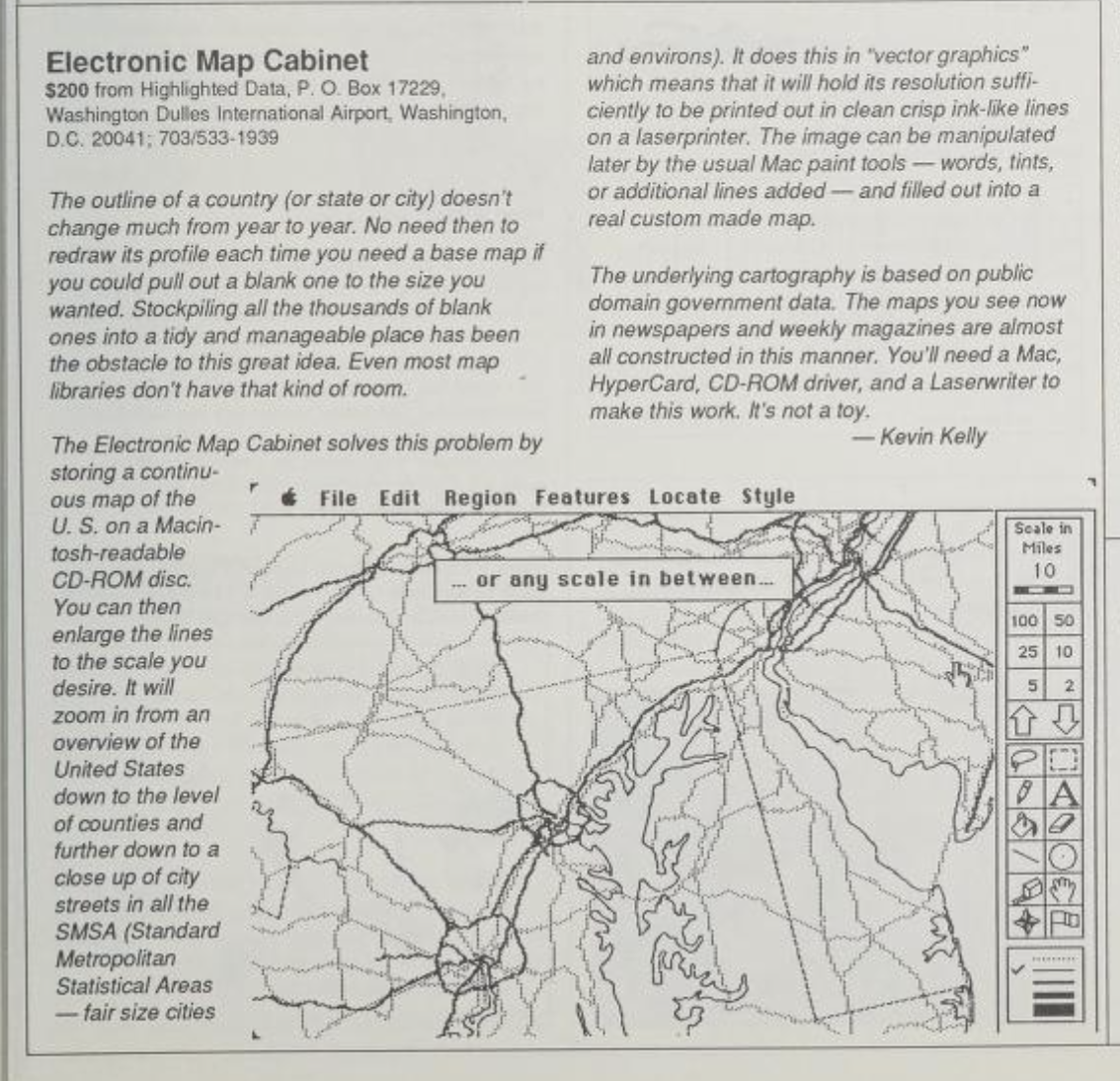
For the most part, industry-standard desktop geospatial software products are and have been PC-only—I imagine it’s a “Macs were niche when we built this codebase and we can’t be fucked to rewrite for cross platform” situation—so seeing a Mac-specific, Hypercard-based product (even if it seems to be more of a “here’s some map layers you can fuck around with” than an actual geospatial analysis tool in the late 1980s) is intriguing. Unfortunately there’s not much about Highlighted Data Inc. out on the open web beyond old scanned catalogue listings and Rick’s documentation of his collaboration with them. Apparently they also did a Hypercard CD-ROM of Webster’s dictionary? Sure. Something for me to bring to the guy who worked on geospatial stuff for Apple in the “hypermedia” era (!!) who I’m meeting with next week.
Computers and Automation
One suggestion from Rick on library items that might have leads was their bound editions of the magazine Computers and Automation, later renamed Computers and People. The Internet Archive has scans of Computers and Automation in their collection, which is helpful for me because the Prelinger Library doesn’t have a full set of the magazine’s run—I looked at issues from 1967-68 (the oldest set in the collection), 1971, and 1973-4. (There were more, but I only did a few hours at Prelinger because it turned out Aaron was in town for one more day and had time after I saw Jesse and well, when Aaron Straup Cope has time for a coffee you seize and savor that time.)
I’m glad I went through physical magazines first though, because it’s useful to see all the other articles and the ads in the magazine alongside whatever niche maps-and-computers stuff I found. Going through the magazine is basically watching an industry and profession situate and understand itself over time. Also, the graphic design in the magazine is truly something to behold and the scans disappointingly seem to be mostly black and white. The ads!
Described in some places (OK, in Wikipedia) as “arguably the first computer magazine”, Computers and Automation was edited by Edmund C. Berkeley, mainly famous for co-founding the Association for Computing Machinery in 1947 and for publishing a book in 1949 with the absolutely insane title Giant Brains, or Machines That Think, which was sort of the first for-nontechnical-audiences book on computing in the postwar era. Berkeley got into computers during the war as an operator on the Mark I, and postwar he worked at Prudential Insurance earnestly trying to get the company to adopt the then-nascent digital technologies (also becoming an anti-nuclear war activist in the process because uh a risk-averse industry like insurance might have thoughts on nuclear annihilation). An ACM biographical article about him includes a very funny list Berkeley composed of his personal faults prior to leaving Prudential to work as a consultant:
1 Can’t start too many things at once.
- Enth[usiasm] lacking: Prudential hold.
- Not clear what you are. Moody salesmanship.
- Unconscious conflicts.
Relatable guy! I too suffer from being “not clear what you are.”
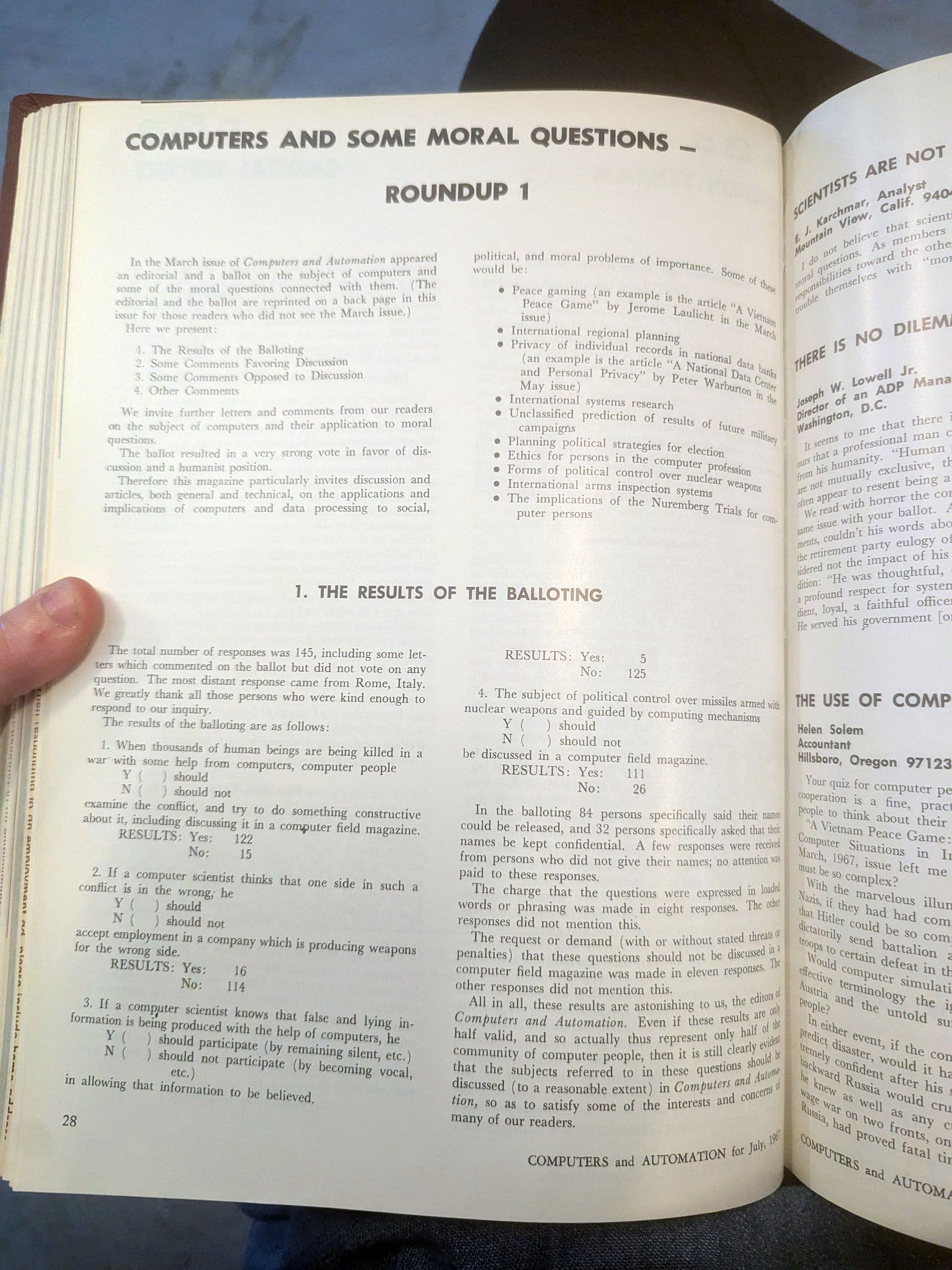
While Berkeley was interested in getting ordinary people to understand and appreciate computers,Computers and Automation seems very much to be for what some of the issues I read called “computer people.” Not just in terms of technical articles, but in terms of defining what it is to be a computer person and how computer people should act in shaping the world with technology. The issues I went through often engaged with questions of morality of computer applications, especially relative to the Vietnam War. They ran polls about this in the magazine!
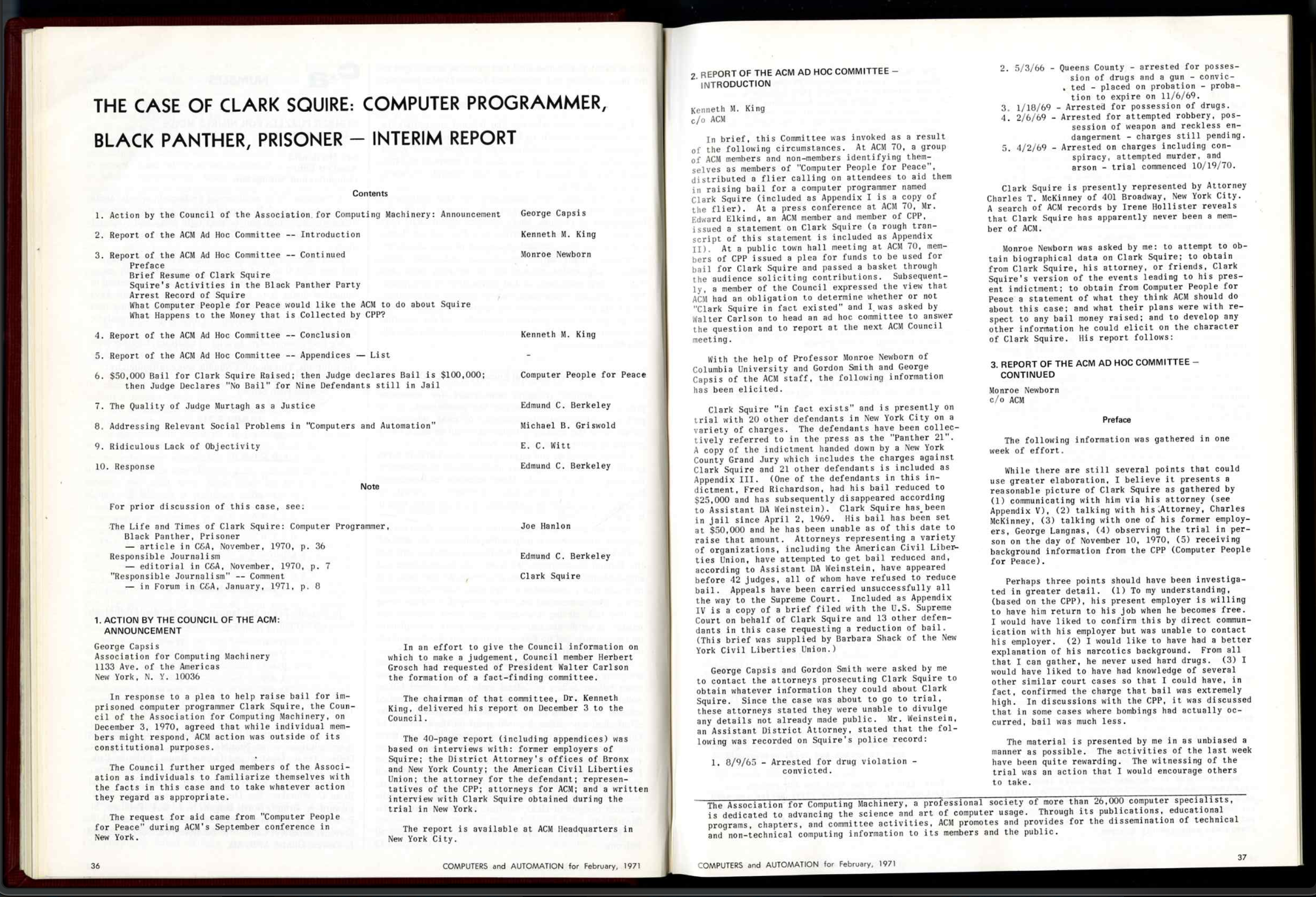
In 1971 Computers and Automation were (or maybe Berkeley personally was) very interested in the case of Clark Squire, the Black Panther (or as their headlines described him, computer programmer and Black Panther) and member of the Panther 21. It’s not directly related to my dissertation, but I did scan the magazine’s report on the Squire case because it’s the sort of thing I want to share with students when I teach CS ethics. Computer labor has always been a multifaceted culture where the politics of computing have been debated and solidarity has existed, which maybe is good for the youth to know.
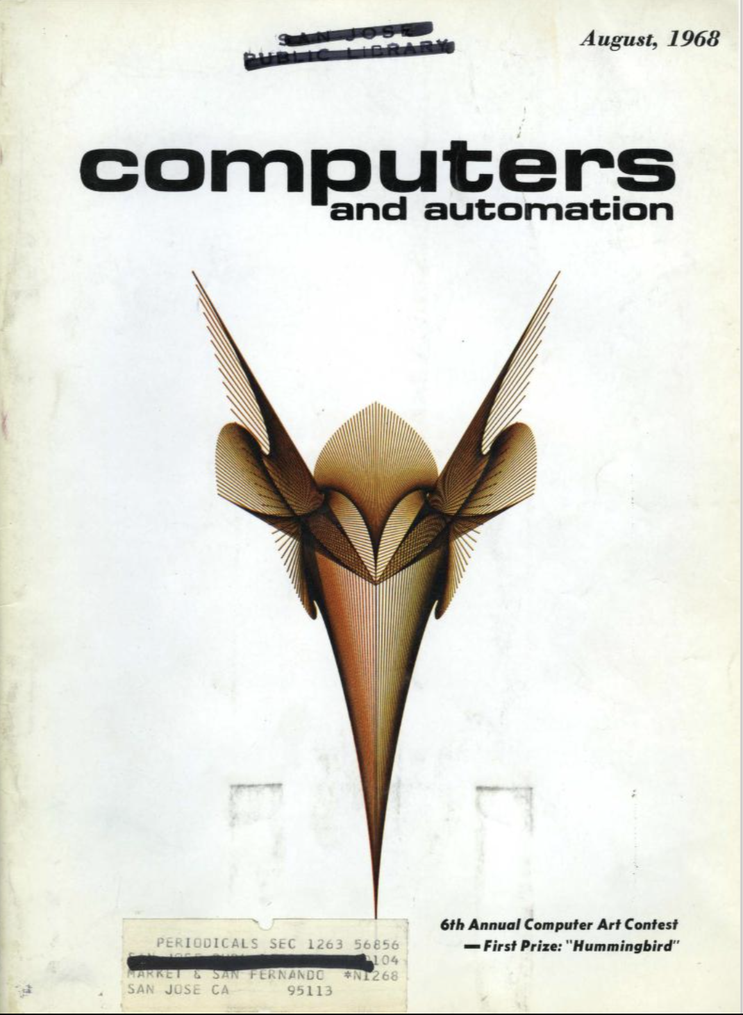
Also, every year the magazine had a “computer art” contest featuring various visual experiments in what wasn’t yet called creative coding. (This is a real disappointment of the black and white scanning of the Internet Archive collection, but the color covers are a treat.)
At some point in the 1970s Berkeley got obsessed with the JFK assassination and every issue of the magazine had at least one article related to it, often written by him. Hard to imagine a computer magazine having a regular “Computers, Science, and Assassinations” section today. This is the sort of stuff you miss if you just go to the Internet Archive collection and do a text-search for mapping! Stuff that uh, is probably not dissertation-germane and I am maybe spending too much time on in this blog post, ha ha ha.
This is all cute Ingrid but what about the dissertation research
Mapping-specific articles were admittedly not super-common in the issues I went through. I found two. But I was excited to see them, especially because they weren’t written by people associated with well-known companies and institutions of computer map lore. Not knowing about the Internet Archive scans until I got home, I scanned the magazine articles I found.
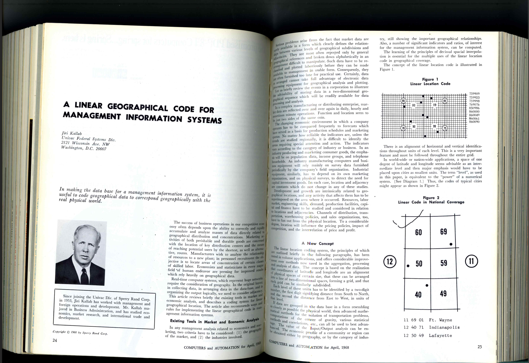
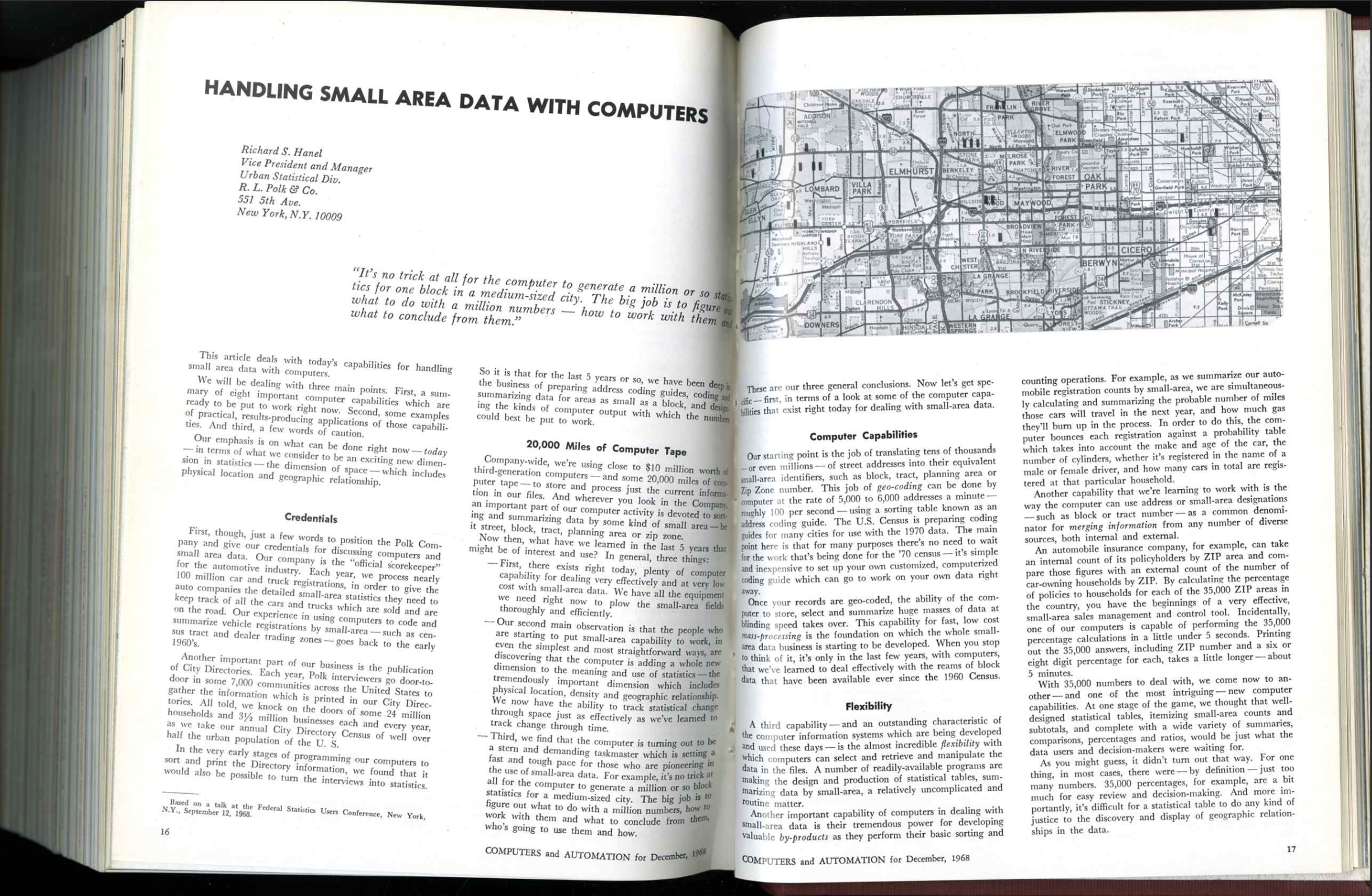
I need to do a closer read of this and other Internet Archive-found articles in the magazine’s collection but just as a high-level think it’s useful for getting a read on mapping work happening contemporaneously to the Harvard Lab and other academic research.
Also, mapping contract listings (mostly what I learned about Bunker-Ramo)
Another research find in Computers and Automation that had some fun leads: every month the magazine published a table of “new contracts” between computer firms (hardware and software) and government agencies (and sometimes companies). I guess Berkeley compiled this from news articles and/or press releases himself? It’s not likely a complete picture of all computer contracts happening at any given time, but it does give a sense of what kinds of projects people were getting paid to work on—some of which were weird as hell to see. October 1968: Lockheed Missiles and Space Systems of Sunnyvale, CA awarded an unknown-amount contract from the state of Minnesota for “help in designing an information system to aid in planning the administration of criminal justice”? November 1968: a contract to North American Aviation’s Autonetics Division of Anaheim, CA from the city of Redondo Beach, CA for “aiding in streamlining the information procedures of moderate-sized police departments with the application of techniques developed in the aerospace industry”?? Sure, man. This is probably fine and normal and will have no broader repercussions. (Also wild to see these kind of contracts happening so early on!)
Did I find a lot of geospatial or maps-related contracts? It kind of depends on how expansive you want to be with defining “geospatial computing.” Is avionics geospatial computing since it involves navigation? I guess yeah, but I also don’t understand airplane problems enough to fully understand what’s going on in avionics contracts. An IBM subcontract to California Computer Products in December 1967 for a “militarized digital plotter” for us in “tactical information processing and interpretation systems” on a larger contract with the Wright Patterson Air Force Base—probably plotting navigation charts? Is that geospatial computing? I guess? In the interest of time I wasn’t reading deeply between the lines.
In the 1967-68 issues I found a few mapping contracts (as in, contracts explicitly mentioning mapping) listed for the Bunker-Ramo Corporation of Canoga Park, CA:
- October 1967: $250,000 from the US Army Engineers Research and Development Laboratory for “digital computer equipment for use in the Rapid Combat Mapping System (RACOMS).”
- September 1968: $3,099,999 from the US Army Map Service for “up to three computerized map-making systems, known as UNAMACE (Universal Automatic Map Compilation Equipment). UNAMACE automatically prepares terrain contour charts and orthographically correct photos from stereo aerial photos.”
- November 1968: Bunker-Ramo subcontracted Redcor Corporation (also of Canoga Park) to build circuit modules “for construction of photogrammetry and mapping systems for the US Army” to the tune of $300,000.
Bunker-Ramo was a joint venture of Martin-Marietta and Thompson Ramo Woolridge (better known as TRW), founded by George M. Bunker (then president of Martin-Marietta) and Simon “father of the ICBM (????)” Ramo. It seems like it was sort of a holding entity created for TRW’s computers division.
Here’s some images from a 1969 issue of The Military Engineer article on JSTOR about UNAMACE that illustrates what the outputs of its topographic map generator looked like:
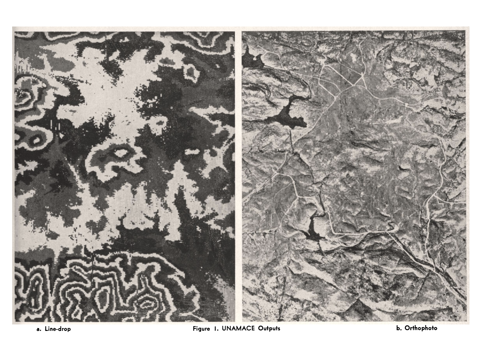
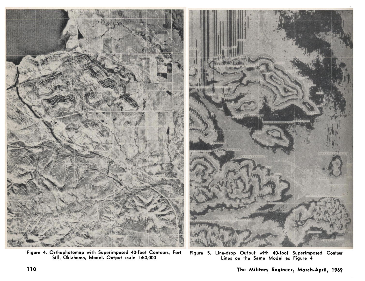
There’s also a pretty good 1968 article about UNAMACE and a product called the “Automatic Photomapper”, a compact UNAMACE-type setup designed for I guess real-time field operations, written by Bunker-Ramo employee Sidney Bertram (who submitted a brief autobiographic sketch to the Engineering and Technology History Wiki). RACOMs and the Automatic Photomapper sound sort of similar, it’s not clear to me if the latter became the former or the other way around.
While it’s not explicitly mentioned in the 1960s coverage, UNAMACE appears to have been used in conjunction with the CORONA spy satellite program. There’s a photo of a UNAMACE setup in a 2016 article about rectifying Corona imagery (to be clear, the caption notes that UNAMACE was more of a post-processing tool, with geo-rectification being a separate step). I don’t know if UNAMACE was made specifically for CORONA—the spy satellite program started in 1959, and UNAMACE started development in 1960 so it’s possible? The Engineer Topographic Laboratories history linked in the previous sentence from 1979 frames UNAMACE’s development as a response to basically data bottlenecks from increased aerial imagery collection, but CORONA also wasn’t declassified until 1995 so “oh no so much data” might be a cover story. I’m afraid this maybe means I have to go back to the College Park National Archives wing, guys.
The salient things that are actually maybe useful to the dissertation in the Bunker-Ramo rabbit hole:
- Another answer to the “what technical tasks did the military specifically want done with computers” (in addition to “how to make sure missile goes boom where we want” and “how many nukes do the Soviets have”, there’s “I guess just how hilly is that terrain we have to sent soldiers out to”)
- An example of the technical achievements in digital/computer mapping happening in the military contemporaneous to and sometimes preceding academic and civilian government work that just doesn’t end up in the GIS history canon for various reasons
At a higher level, there’s something maybe useful here about professionalization and politicization, both in geography and computer engineering, and the specific problems geospatial computing projects sought to solve for clients and/or funders.
I’m in California for another 8 days, of which 5 days have interviews booked, so hopefully I’ll be able to fit in another session at the Prelinger Library. (But if you, gentle reader, are in the Bay Area and some fun geospatial software history stories you want to share with me, please don’t hesitate to reach out while I’m here!!)